Har Ki Dun Trek 2026 – 7 Days from Dehradun (Itinerary, Cost & Route)
Har Ki Dun is a 6-night, 7-day valley trek in Govind Pashu Vihar National Park, Uttarkashi district, Uttarakhand. You drive from Dehradun to Sankri, walk about 44–46 km return from Taluka to a high valley at roughly 3,500 m (about 11,700 ft), and look straight at the Swargarohini range. It is graded moderate: no technical climbing, but long days and a real altitude gain. The best windows are March–June and September–November. A group departure from Dehradun typically costs ₹10,999 per person;
Har Ki Dun Trek at a Glance
Essential details about the Har Ki Dun Trek, including its location, distance, altitude, difficulty, best season and package price.
| Detail | Information |
|---|---|
| Region | Govind Pashu Vihar National Park, Uttarkashi, Garhwal Himalayas |
| Duration | 7 days / 6 nights from Dehradun |
| Base Village | Sankri (about 1,900 m) |
| Trek Start | Taluka, 12 km by road from Sankri |
| Walking Distance | About 44–46 km round trip |
| Highest Point | Har Ki Dun Valley, about 3,500–3,566 m (11,500–11,700 ft) |
| Difficulty | Moderate |
| Technical Climbing | None |
| Best Months | March–June, September–November |
| Optional Side Trips | Marinda Tal, Jaundhar Glacier viewpoint |
| Group Price | ₹10,999 per adult from Dehradun |
Why people choose Har Ki Dun
Most Himalayan treks reward you with one summit view. Har Ki Dun is different: it is a long walk into a landscape. You start among terraced fields and wooden houses, pass through one of the oldest inhabited villages in the region, move through deodar and maple forest, and finish in an open glacial valley with Swargarohini and its neighbouring peaks closing off the horizon.
The valley’s name is usually read as “Valley of the Gods” (Har referring to Shiva, Dun meaning valley). Local belief links the region to the Pandavas’ final journey, and the village of Osla keeps a temple to Duryodhana, which is unusual in India and one reason this walk has a cultural side that few other beginner treks offer.
The Route, Stage by Stage
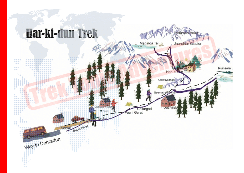
The Har Ki Dun trail follows the Supin River upstream along a generally easy-to-follow route. Under normal conditions, there are few confusing junctions, but weather, visibility and trail conditions can change. Follow your trek leader’s guidance throughout the trek.
Dehradun to Sankri
The journey covers approximately 200 km via Mussoorie, Purola and Mori. Allow around 8–10 hours, depending on traffic, road conditions and stops along the way.
Sankri to Taluka, Then Taluka to Seema
Travel by road from Sankri to Taluka, then begin walking towards Seema. The trail follows the river through forest, small waterfalls and village sections. The walking distance is approximately 12 km; confirm the exact day’s route and distance with your trek operator.
Seema to Osla and Har Ki Dun Valley
Pass through Osla village before continuing along forested slopes and ridge sections towards Har Ki Dun. The landscape gradually opens into the valley, and this is one of the more demanding stages of the trek, with significant climbing along the route.
Explore Har Ki Dun Valley
Spend time exploring the valley and allow yourself to rest and acclimatise. If weather, trail conditions and your trek leader permit, you may walk towards Marinda Tal or a suitable viewpoint in the direction of the glacier.
Har Ki Dun to Seema, Taluka and Sankri
Return along the same trail, retracing your route through the valley and forest sections towards Seema and Taluka, followed by the road transfer to Sankri as arranged in your itinerary.
Return Trek: Protect Your Knees
Walking back along the same trail can feel easier because the route is familiar, but long descents can put extra strain on your knees. Trekking poles, supportive footwear, steady pacing and regular breaks can help. Always follow your trek leader’s instructions and adjust the pace to the trail and weather conditions.
How Difficult Is Har Ki Dun?
Har Ki Dun is considered a moderate Himalayan trek. It is more demanding than a short weekend trek, but generally less challenging than demanding high-altitude passes such as Rupin Pass or Bali Pass. The difficulty comes from several days of walking, altitude and cumulative fatigue rather than one single technical section.
01. Trek Distance
Expect several consecutive days of walking, often around 8–12 km per day depending on your itinerary and campsite locations.
02. High Altitude
The valley lies above 3,500 metres. Some trekkers may experience headaches, breathlessness or disturbed sleep at altitude.
03. Uphill Climbing
The approach from Seema towards Har Ki Dun includes sustained climbing. A steady pace and planned breaks help manage fatigue.
04. Trail Conditions
Expect forest paths, rocky patches, stream crossings and sections that can become slippery after rain or snowfall.
Har Ki Dun Trek Difficulty Rating
Use this overview to understand the fitness, experience and preparation generally needed for the trek.
| Difficulty Factor | What to Expect |
|---|---|
| Fitness Needed | Moderate fitness; aim to walk comfortably for 5–6 hours. |
| Technical Skills | No specialised climbing skills are normally required, but basic trekking skills are useful. |
| Altitude Risk | Altitude illness is possible. A rest day does not eliminate the risk. |
| First-Time Trekkers | Possible with suitable preparation, a sensible itinerary and experienced guidance. |
| Children | Suitability depends on the child’s fitness, health, experience, weather and itinerary. Consult an experienced trek operator before planning. |
How to Prepare for Har Ki Dun
Start preparing around 4–6 weeks before your trek, adjusting the intensity to your current fitness level.
- Walk or jog for 30–45 minutes, four or five days a week.
- Add stair climbing or hill walks to practise uphill effort.
- Build leg strength with squats, lunges and calf raises.
- Practise walking with a daypack similar to the one you will carry.
- Increase distance and effort gradually, allowing time for recovery.
- Carry suitable layers, rain protection, water and trekking poles if needed.
Health and altitude: If you have heart or lung conditions, blood-pressure concerns or a history of altitude illness, consult a healthcare professional before the trek. Do not continue ascending if you develop symptoms that could indicate altitude illness; inform your trek leader promptly.
How to prepare: walk or jog 30–45 minutes four or five days a week, add stairs or hill walks, and do squats, lunges and calf raises. Practise with a loaded daypack. See a doctor first if you have heart, lung, blood-pressure or previous altitude problems.Best time to do the Har Ki Dun trek
Best Time to Plan Your Har Ki Dun Trek
The best time for the Har Ki Dun Trek depends on the scenery you want, the temperature you prefer and your comfort with snow or changing mountain conditions. Use this month-by-month guide to plan your trip.
For a more detailed seasonal breakdown, read our Har Ki Dun Trek Best Time guide .
| Month | What to Expect |
|---|---|
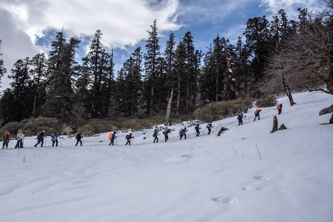
| March | Cold weather, snow in the upper valley and slower progress on some trail sections. |
| April | Snow begins melting, mornings remain cold and there are generally fewer crowds. |
| May–June | Warmer days, green forests and cold nights. One of the most popular trekking windows. |
| July–August |
Monsoon conditions can bring heavy rain, landslides on the Sankri road and slippery trails.
Not recommended in typical monsoon conditions |
| September | Fresh greenery after the rains, with clearer skies beginning to return. |
| October | Often crisp air, cold nights and excellent mountain visibility. |
| November | Colder weather, quieter villages and possible snow at higher elevations. Many operators finish the regular season around this time. |
| December–February | Heavy snow and temperatures well below freezing may occur. Suitable only for experienced groups on dedicated winter departures with appropriate arrangements. |
Cold weather, snow in the upper valley and slower progress on some trail sections.
Snow begins melting, mornings remain cold and crowds are generally fewer.
Warmer days, green forests and cold nights. One of the most popular trekking windows.
Monsoon brings a risk of heavy rain, landslides on the Sankri road and slippery trails. Not recommended in typical monsoon conditions.
Fresh greenery after the rains, with clearer skies beginning to return.
Crisp air, cold nights and often excellent mountain visibility.
Colder weather, quieter villages and possible snow higher up. Many operators finish the regular season around this time.
Heavy snow and temperatures well below freezing may occur. Consider only dedicated winter departures with experienced groups and suitable arrangements.
Which Season Suits You?
Choose your trekking window based on your preferred scenery and conditions.
Important: Mountain weather can change quickly. Actual trail access, snow conditions, road status and departure availability vary each year. Check current local conditions and operator guidance before travelling.
Want more detail before choosing your dates? Visit our complete Har Ki Dun Trek seasonal guide for additional planning information.
Har Ki Dun Trek Cost: What You Will Actually Pay
The cost of the Har Ki Dun Trek depends on the departure season, group size, accommodation style and services included in your package. Group departures from Dehradun typically fall within the operator’s quoted package price range.
Indicative group package price from Dehradun. Confirm the current price and inclusions before booking.
What a Group Package Normally Covers
- Transport from Dehradun to Sankri and Sankri–Taluka transfer (confirm the exact pickup)
- Accommodation in Sankri and on the trail, in a guesthouse or tents
- Meals during the trek
- Trek leader and support staff
- Forest permits and camping charges
- Basic first-aid kit
What Is Usually Not Covered
- Travel to Dehradun
- Personal trekking gear and rental
- Backpack offloading by mule or porter
- Travel and emergency evacuation insurance
- Extra hotel nights and meals outside the itinerary
Before booking: Package inclusions can vary by operator and departure. Confirm transport, meals, accommodation, permits and any additional charges in writing so you know exactly what the quoted price covers.
Going Independently vs. Joining a Group
You can organise the Har Ki Dun Trek independently by taking a bus or shared taxi to Sankri, arranging the required forest permits, and hiring a local guide or porter where needed. Depending on the season and services you choose, this may reduce some costs.
More flexibility over arrangements, but you need to manage transport, permits, accommodation, meals, local support and changing weather conditions yourself.
Trek logistics, meals, tents and support staff are generally coordinated as part of the package. Confirm emergency communication and evacuation arrangements before departure.
Safety matters: Remote Himalayan trekking involves weather, altitude and evacuation risks. Independent trekkers should plan carefully, check current local requirements and arrange suitable trekking insurance.
Permits and rules
Har Ki Dun lies inside a national park, so forest entry permits and camping charges apply. Operators normally arrange these. If you trek independently, enquire at the forest office in Sankri about current fees and rules, since these are revised from time to time.
Altitude and safety basics
Har Ki Dun does not go extremely high, but altitude sickness can still happen. Early symptoms include headache, nausea, tiredness and poor sleep. Tell your trek leader straight away. Severe symptoms such as confusion, breathlessness at rest or loss of balance mean descend and seek help immediately. Ascending further with worsening symptoms is never acceptable. Buy a policy that explicitly covers trekking at altitude and emergency evacuation.
Har ki dun Trek Highlights
- Enjoy breathtaking views of the legendary Swargarohini Massif, believed in Hindu mythology to be the pathway to heaven taken by the Pandavas. The snow-capped peaks provide some of the most spectacular Himalayan panoramas throughout the trek.
- Trek through the stunning Har Ki Dun Valley, one of Uttarakhand's most beautiful and ancient Himalayan valleys. Surrounded by lush meadows, dense forests, and towering mountains, the valley offers unforgettable natural beauty.
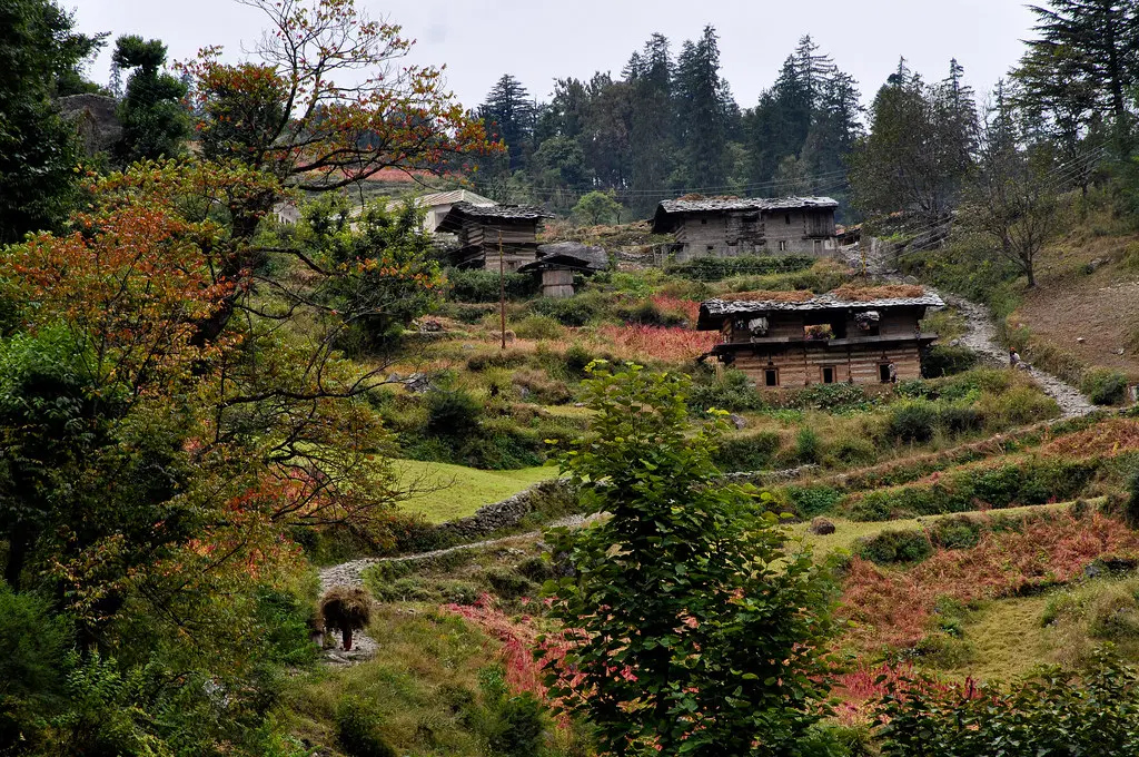
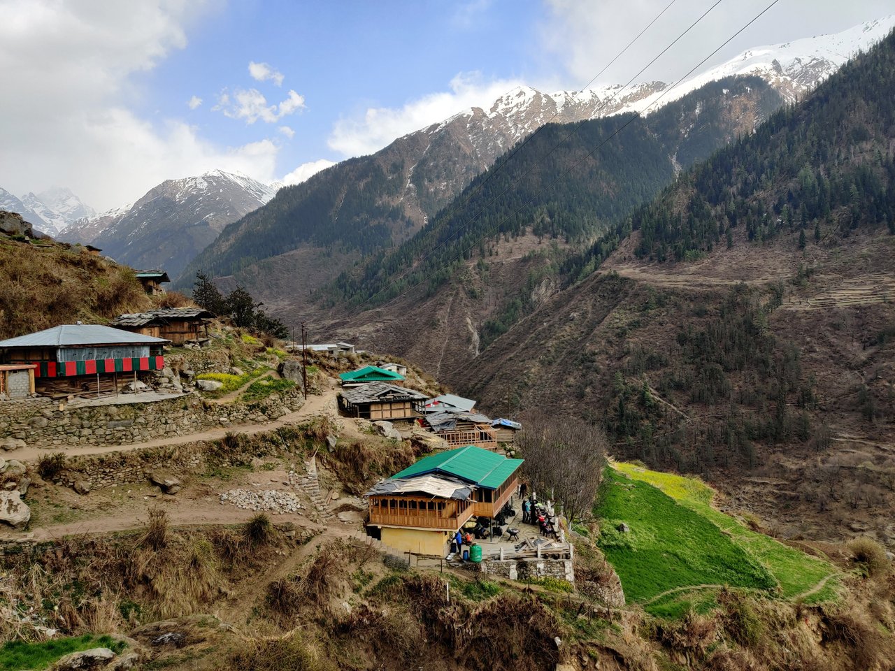
- Visit traditional villages like Osla and Seema, known for their unique wooden architecture, rich cultural heritage, and centuries-old traditions. Experience the authentic lifestyle of the Himalayan communities.
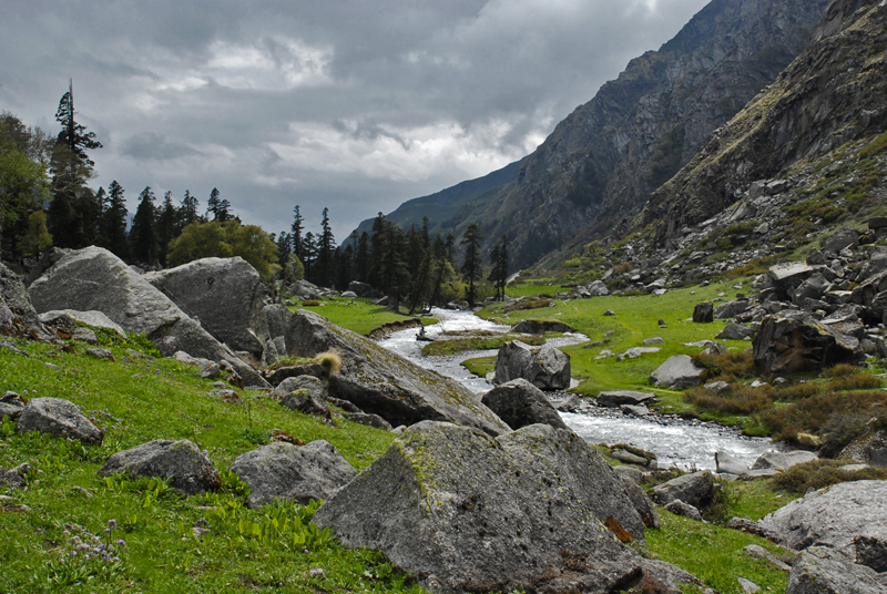
- Walk through enchanting forests of pine, oak, and deodar while crossing scenic rivers, wooden bridges, and vast alpine meadows filled with seasonal wildflowers and stunning landscapes.
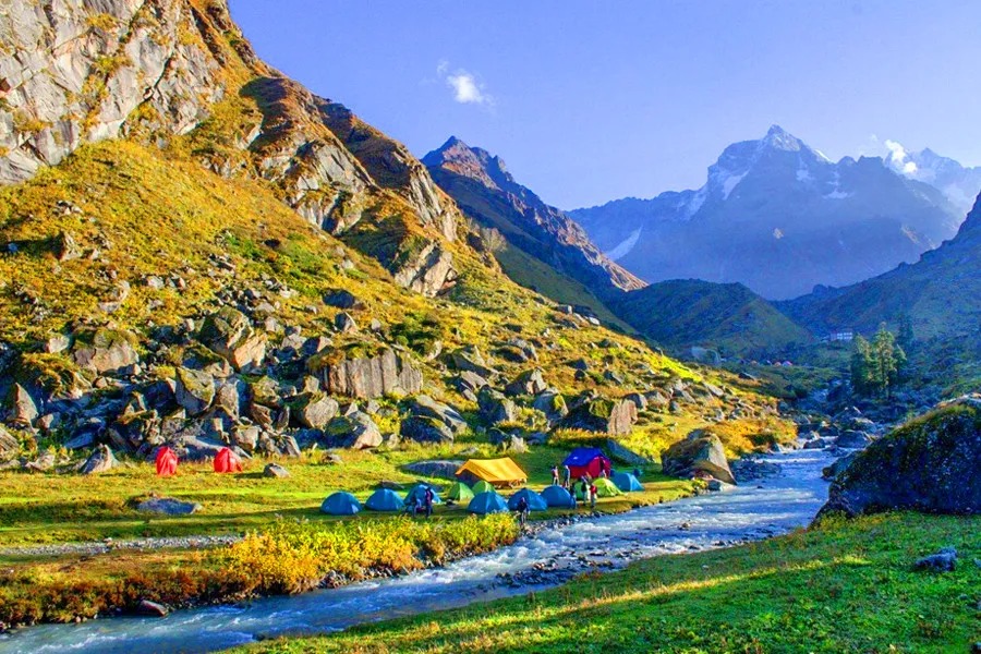
- Camp amidst pristine wilderness surrounded by mountains, rivers, and forests. Wake up to mesmerizing Himalayan sunrises and spend nights under a sky full of stars in the heart of the Garhwal Himalayas.